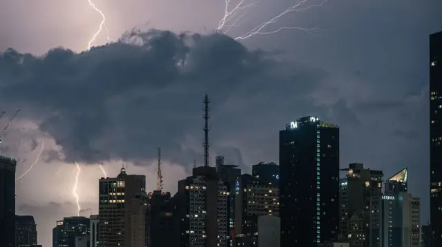
Typhoon Season in the Philippines: A Survival Guide for New Expats
12 min read
Facing your first typhoon season in the Philippines can feel intimidating if you just moved here. International news fills the screen with flattened coastal villages and waist-deep floodwater, so feeling nervous is completely normal.
On the ground, everyday life through a storm is much more manageable than those clips suggest. If you live in a modern high-rise or an established subdivision, a passing typhoon is usually a multi-day inconvenience rather than a personal disaster. Power flickers out and streets pond with water, but with some basic routines in place, you can ride them out safely and comfortably.
Here is what you need to know: storm timing, how the official warning signals work, how to prep your home, and what to do when a storm hits.
When typhoon season runs
Around 20 tropical cyclones enter the Philippine Area of Responsibility each year, according to PAGASA data (accessed October 5, 2026). PAGASA records show that about 8 to 9 of those systems make landfall or cross the islands directly.
The season peaks between July and October, accounting for nearly 70 percent of all typhoons. That stretch coincides with the wet southwest monsoon (habagat), which drags heavy rain bands straight across Luzon and the Visayas.
Do not drop your guard when November arrives. The late-year "ber" months regularly spawn severe, fast-moving storms fed by warm ocean waters. Typhoon Yolanda (Haiyan), one of the deadliest typhoons in Philippine history with over 6,300 deaths, struck in November 2013.
Storms can form during any month of the year. The calendar is a rule of thumb, not a schedule. PAGASA records show cyclones spinning up in January, April, and May, so keeping basic supplies on hand all year round is smart practice anywhere in the country.
How PAGASA warns you
PAGASA tracks storms and issues warnings through its Tropical Cyclone Wind Signal (TCWS) system. The bureau updated the framework to its current five-tier scale on March 23, 2022.
The five wind signals set clear expectations for wind strength and arrival times:
Signal 1 brings winds of 39 to 61 km/h within 36 hours. You will see light damage to very light structures, swaying trees, and scattered rain showers. Use this window to check your emergency gear.
Signal 2 brings gale-force winds of 62 to 88 km/h within 24 hours. Expect minor roofing damage, tilted small trees, and halted maritime ferry travel. Bring outdoor furniture inside.
Signal 3 brings storm-force winds of 89 to 117 km/h within 18 hours. Winds this strong damage light materials, snap tree branches, and knock out local power lines. Stay indoors.
Signal 4 brings typhoon-force winds of 118 to 184 km/h within 12 hours. Homes can suffer heavy structural damage, roofs tear off, trees get uprooted, and utilities go down for extended periods.
Signal 5 brings winds of 185 km/h or higher within 12 hours. This is super typhoon territory, bringing extreme danger and widespread destruction to buildings and the electrical grid.
PAGASA also classifies storms by sustained winds near the center (PAGASA, accessed October 5, 2026): Tropical Depression (up to 61 km/h), Tropical Storm (62 to 88 km/h), Severe Tropical Storm (89 to 117 km/h), Typhoon (118 to 184 km/h), and Super Typhoon (185 km/h and above). Signals do not always tick up one by one. If a system rapidly intensifies offshore, PAGASA can skip a level and go straight from Signal 1 to Signal 3.
Wind is only part of the risk
Wind makes the most noise, but water causes most of the damage. PAGASA runs a color-coded rainfall warning system that you need to follow alongside the wind signals:
A Yellow Warning indicates heavy rain of 7.5 to 15 mm per hour, which can flood low-lying streets. An Orange Warning flags intense rainfall between 15 and 30 mm per hour, meaning flooding is a definite threat. A Red Warning means torrential rain exceeding 30 mm per hour; serious flooding is expected, and low-lying communities are told to evacuate.
Along the coast, watch for storm surge, known as daluyong ng bagyo in Filipino. PAGASA defines a storm surge as an abnormal sea-level rise driven by low atmospheric pressure and strong onshore winds pushing ocean water inland.
Storm surge is most dangerous when it lines up with high tide, pushing seawater far onto coastal land. If your local disaster office (MDRRMC) or barangay directs low-lying coastal areas to move to high ground, evacuate immediately.
Where typhoons hit hardest
Typhoon risk depends heavily on where you decide to live. Most storms form over the open Pacific and move west, so eastern-facing coastlines take the brunt of direct landfalls.
Regions like Eastern Visayas, Bicol, and northern Luzon take frequent direct hits at full strength. Living in those areas demands thorough, disciplined preparation.
Mindanao, by contrast, sits largely outside the typhoon belt. Cities like Davao lie south of common storm tracks, making them attractive if you want to sit out most of storm season. Largely is not entirely: Pablo (Bopha) hit eastern Mindanao in December 2012, and Sendong's floods devastated Cagayan de Oro in 2011. Cebu gets natural shielding from the islands to its east, which reduces direct eye impacts, though strong wind and heavy rain still push through.
Metro Manila has its own dynamic. Direct landfalls by major typhoons are relatively rare because the Sierra Madre mountain range shields the metro from the east. But monsoon rains regularly flood low-lying avenues, bringing street traffic and business districts to an abrupt halt for hours.
Getting your home ready before the season
Preparation starts long before the skies darken. When choosing housing, check whether your street sits in an established flood basin. Ask neighbours about street flooding during past storms and check local hazard maps before signing a lease.
If you rent or own a condo, get contents insurance right away. Master building policies cover the outer shell and shared areas, not your furniture or personal electronics. Photograph your rooms, appliances, and gear, then upload the photos to cloud storage.
Scan your essential paperwork: passport bio page, entry visa, Alien Certificate of Registration (ACR I-Card), and lease contracts. Keep encrypted copies on your phone and an external drive.
Pack a proper go bag. The National Disaster Risk Reduction and Management Council (NDRRMC, accessed October 5, 2026) recommends keeping at least three full days of supplies ready for every household member. Pack these essentials in a water-resistant backpack:
- Bottled drinking water (about 3 to 4 liters per person daily)
- Ready-to-eat, non-perishable food (canned tuna, corned beef, biscuits) and a manual can opener
- Prescription medicines for a week, plus a first-aid kit
- A bright flashlight with spare batteries
- Charged high-capacity power banks
- A small battery-powered or hand-crank AM/FM radio
- A rescue whistle
- Paper copies of your passport, visa, and insurance in a waterproof zip bag
- Cash in small peso bills (50, 100, and 500 notes)
- Phone charging cables
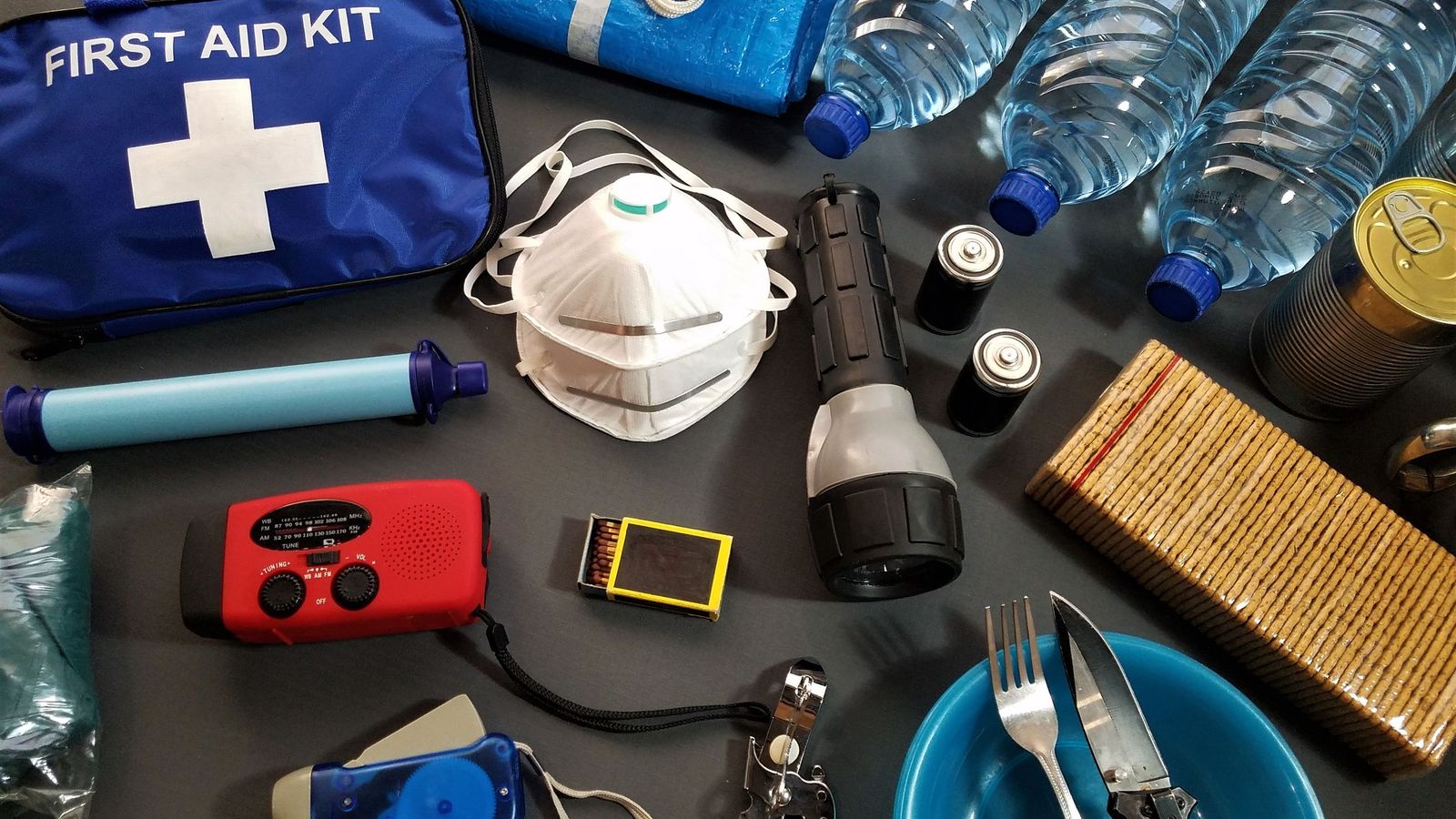
Keep another 2 to 3 days of extra food and water in your pantry. Find out where your barangay evacuation centre is located so you know where shelters open if floodwaters rise.
When a storm is on the way
Once a storm enters the Philippine Area of Responsibility, you typically have 48 to 72 hours before local conditions turn sour. Use that time methodically.
Check PAGASA directly through their official site (pagasa.dost.gov.ph) and verified social media accounts. Wind visualization apps look clean, but local authorities base emergency declarations strictly on PAGASA bulletins.

Clear balconies and patios. Bring outdoor chairs, potted plants, and drying racks indoors before winds turn them into dangerous projectiles. Make sure all window latches lock tight.
Fill clean water jugs, buckets, and bathtubs. Municipal tap water often cuts off when treatment plants lose electrical power or intake lines clog with silt. Having stored tap water lets you flush toilets and wash during utility outages.
Hit an ATM immediately. When power drops and cell towers go offline, cash machines and card readers stop working. Digital wallets like GCash fail without a working mobile data connection. Having cash in hand lets you buy supplies from neighbourhood sari-sari stores.
Expect travel disruptions across the board. The coast guard suspends ferry routes and port operations as soon as signals go up, and airlines ground domestic flights early. Always verify booking status before heading to an airport or pier.
Track school and government work suspensions. Under Executive Order No. 66 (2012), Signal 1 suspends preschool classes; Signal 2 suspends preschool, elementary, and high school; and Signal 3 or higher halts all classes up to tertiary levels and suspends work in government offices. DepEd's 2026 order (DO 14) pushes schools toward localized decisions rather than automatic blanket suspensions, and Local Government Units (LGUs) hold broad authority to call suspensions based on heavy local rainfall, so treat the signal rules as a baseline. Check your city mayor's social media page for daily suspension announcements.
During and right after the storm
Stay indoors once the storm arrives, away from exterior glass doors and wide windows that could shatter under strong gusts. Unplug computers, televisions, and major appliances to guard against power surges before the electrical grid drops.
If the wind abruptly dies down and blue sky appears, stay put. You are likely in the calm eye of the storm. Violent winds will kick back up without warning from the opposite direction as the back of the eyewall moves over. Stay inside until PAGASA reports that the center has moved away from your area.
Never wade or drive through standing floodwater. "Turn Around, Don't Drown" applies everywhere here. Philippine floodwaters hide open manhole covers, sharp scrap metal, and downed electrical lines. Floodwater also carries leptospirosis, a dangerous bacterial infection spread through animal urine that enters through tiny cuts in your skin.
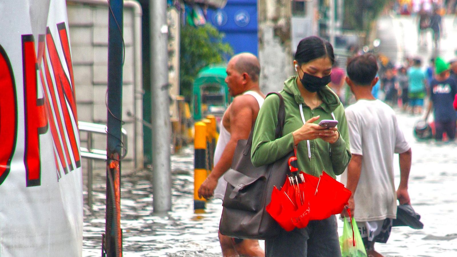
Utility outages often drag on after the storm clears. Blackouts and water outages can last several days in provincial areas, while central metro districts usually come back online within 24 to 48 hours. Stay off roads so utility crews can remove fallen trees and string up downed lines.
Treat municipal tap water with caution after a flood. As advised by DOST and health authorities (DOH, accessed October 5, 2026), boil tap water thoroughly before drinking or preparing meals, or use water purification tablets. Throw out any perishable food that came into contact with floodwater.
Document any property damage before you clean up. Take clear photos and video of water damage, broken fixtures, or ruined furniture to support insurance claims and reports to your landlord.
Insurance, documents and money
You have to manage your financial risks before the storm forms, because coverage rules are strict. Condominium corporations hold building master insurance, but that policy protects only the common structure. It pays nothing for your soaked furniture, ruined electronics, or damaged interior finishes.
Get your own contents insurance policy. For example, AXA Philippines offers condo security plans covering fire, lightning, and acts of nature—explicitly including typhoons and floods—as well as riot and malicious damage (policy accessed October 5, 2026). Make sure your policy explicitly includes an "Acts of Nature" rider, because basic fire policies routinely exclude flood and storm losses.
Register with your embassy. U.S. citizens should enroll in the Smart Traveler Enrollment Program (STEP), run by the U.S. State Department and used by the U.S. Embassy in Manila. Registering with STEP lets the embassy send you alerts and reach you during a disaster, and it helps if you need emergency travel documents.
Keep physical photocopies of your passport photo page, visa stamp, and ACR I-Card in a waterproof pouch inside your go bag. If you need clinic care after a storm, printed copies of your health insurance documents speed up intake.
Maintain dual mobile connectivity so you are not stranded when networks drop. As detailed in our guide on SIM cards and mobile data, keeping both Globe and Smart SIMs active gives you a backup if one carrier's local tower goes down.
Emergency numbers to save now
When mobile networks fail, looking up contact numbers online is impossible. Save these numbers in your phone contacts right now and tuck a written copy into your wallet:
- National Emergency Hotline: 911 (for police, fire, and medical response)
- NDRRMC Operations Center: (02) 8911-5061 to 65 (national disaster monitoring)
- PAGASA Weather Bureau: (02) 8284-0800 (direct cyclone alerts and updates)
- Philippine Red Cross: 143 (search, rescue, and emergency medical aid)
- DSWD Disaster Text Line: 0918-912-2813 (social welfare and relief supplies)
Save the emergency phone numbers for your local city DRRMO and your neighbourhood barangay hall as well. Local rescue teams carry out flood evacuations and street clearing, so having their direct lines saved is worth the two minutes it takes.
Your first typhoon season can feel unnerving simply because the weather patterns are unfamiliar. Once your home is secured, your go bag is packed, and you know how to read PAGASA signals, getting through storm season becomes a calm, routine part of living in the Philippines.
Get the free Scout Trip Starter Kit
Chapter 1 of the Decision Pack, plus three printable tools for planning a scouting trip to the Philippines.